
based navigationsystem under nearly realistic conditions.
|
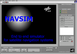
NAVSIM | |
| Tool set for the end-to-end simulation and verification of satellite based navigationsystem under nearly realistic conditions. | ||
| |
||
| [click here for pdf-version of NAV-SIM flyer] | ||
NAVSIM ?NAVSIM is a scientific project realised by the German Aerospace Centre (DLR) and sponsored by the German Government (BMBF). The project aims at the development of a software simulation tool set to support the design and verification of satellite based navigation systems. |
 |
|||
 |
Capabilities ?NAVSIM is developed as a software simulation system used for design and validation tasks in the field of satellite navigation. NAVSIM gives the capability to analyse the GNSS performance under consideration of significant natural and physical impacts related to specified technical characte-ristics of transmitter and reception components. Additionally it can be used as a verification tool with respect to correction models, navigation algorithms and application methods. Its open architecture enables the support of engineers involved in design and development of new navigation satellite systems up to the creation of user-specific application equipment. |
|||
Features
-current and future navigation systems are covered |
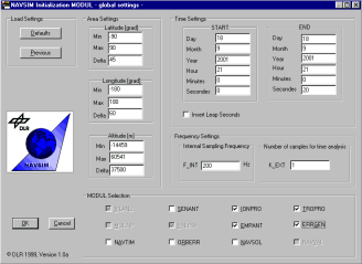
Architecture-two layer concept with an Application Simulation Level (*ASL) based on Windows PC and a Signal Simulation Level
-based on UNIX Workstation |
|||
Extensibility ?The block based software architecture eases the quick adaptation to future requirements by means of system extension and module substitution. Analysis-signal states-ranging/positioning -online/offline Price?NAVSIM is a scientific software and will be applicable to external consulting. |
 |